Altimetry in Borneo
I was fairly common practice to perform Altimetry heighting from helicopters without landing. A weighted graduated line was lowered until at either ground level or tree top level, the altimeter read at the hover and the graduated line read to determine the height above ground or tree top level. I believe the method was pioneered by the first detachment from 19 Topo Sqn under Capt. Baker in 1964. I would point out that the altimeter was NOT lowered to the required level and pulled up quickly and read taking advantage of hysteresis before the reading could change as mentioned elsewhere.
In 1966 1 Topo Troop were performing altimetry from helicopters using Wallace & Tiernan altimeters borrowed from DOS when a Sapper who shall remain nameless dropped one from the helicopter into primary jungle with no possibility of landing to recover it even if it had survived the fall. Needless to say during any future altimetry by air the instruction to ensure security of the instruments was paramount.
From Brian "Nanga" Houldershaw
Re the above. No. 1 Topo Troop under Capt. John White RE were certainly carrying out altimetry from helicopters in Sarawak before the arrival of 3 Troop under Capt. Baker RE. Whirlwind Mk. 10s of 225 Sqn RAF were used to carry two surveyors and Negretti and Zambra altimeters to remote or dangerous areas in the 1st Division close the the border with Indonesia. The altimeters were read inside the cabin of the aircraft once it had moved to the hover position and a land chain was lowered to the ground and read against the sill of the cabin door. These traverses rarely gave satisfactory results but the pilots enjoyed the exercises as we gave them air photographs with which to navigate and locate the selected control points. Normally they had to use rubbishy maps. I remember on one such jaunt we were accompanied by an Ace reporter from the Daily Mirror who promised to give us a mention in his next feature.
Later in 1964, we carried out altimetry traverses
by air, using Hiller and Wessex helicopters of 845 Naval Air Commando
Squadron, within the border regions of the 3rd. Division. We used the
leapfrog method and landed at each required point. The altimeters were
given sufficient time to settle down and the aircraft either shut down
or went fly about until this was done. Furthermore we had the luxury
of using half a dozen Wallace and Tiernan instruments which had
breather tubes which were sealed during flight. These instruments
actually belonged to the United States Army Map Service (Far East) and
had been brought to Sarawak by that famous 'Gravy man', S/Sgt. Carmen
Lisle De Geus who spent six months attached to 1 Troop. He had a
successor SP5 (Buck Sgt.) Steve Hummel who also spent six months with
the Troop before returning to Tokyo. We were supposed to use their
altimeters to back up their Gravity work but needless to say we made
the most of their presence to provide height control to our Position
Line Fixes. From memory I believe the results from these traverses
were more or less acceptable. I can't remember whether we actually
returned these instruments back to the Yanks or even their Gravimeter
and I wouldn't be surprised if the one which was dropped from a great
height was one of them.***
Brian
From Dave "Streak" Hobson
I'd completely
forgotten about that method but we used it a lot.
I can now totally recall the metal drum, handle and rope with all the
markers. (Memories only need a little nudge sometimes don't they)
Did anyone ever give any thought to the effect on the altimeters of
the pressure caused by the rotor blades **?
Streak
From Brian "Nanga" Houldershaw
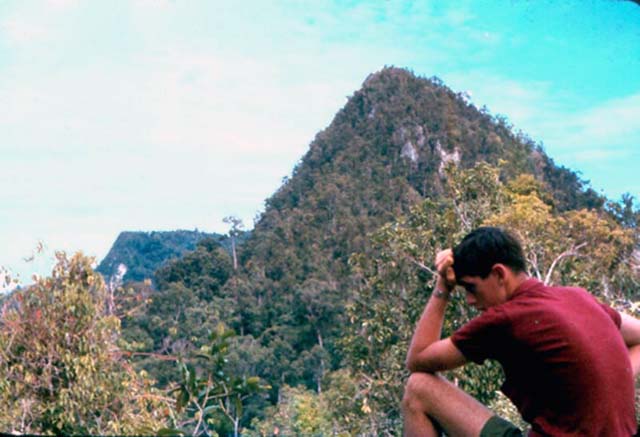
Just in case people reading these articles think that altimetry in Borneo was only carried out by air, I thought that I should add the following riders. In 1963, 1 Topo ran many altimeter traverses throughout the 1st. Division of Sarawak, mainly on foot but if you were really lucky you got to do it by boat. Even so you ran the risk of being sunk, something which I personally experienced. Foot slogging traverses through the jungle were really hard work even though you got regular breaks to read the altimeters. We almost always used the leapfrog method and each team usually carried three or four instruments which gave you quite a bit of leeway when it came to computing an acceptable traverse. We were allowed a misclosure of plus or minus 10 metres which sounds very reasonable but considering that we had to break most of the rules relative to distance and height variation, it was none too generous. If you had the misfortune to finish up with a traverse result which fell outside the desired limits, then you had to do it all over again. It did happen once or twice but the 'wise ones' made sure that it did not happen to them. Also we operated in temperatures ranging between seventy and a hundred degrees Fahrenheit and often through torrential downpours as well as the steaming heat. Rivers often had to be crossed, anything between knee deep to shoulder height and keeping one's fags dry was a real nightmare. I recall setting off on one trip with a near mint I.D. Card, only to return with a washed out illegible version minus the photograph. These trips usually lasted from anything between three to ten days and in border areas we were usually escorted by a section of Infantry. I'm sure that the two Troops seconded from 19 Topo Sqn RE in 1964 also did much of their altimetry by foot and by boat. Choppers were not that thick on the ground that you could demand two at will.
Mention should
also be made that the original Detachment 84 Svy Sqn RE deployed in
North Borneo in the late Fifties, early Sixties, were the real trail
blazers as far as Altimetry in Borneo is concerned. There is the
famous anecdote concerning the rogue elephant which charged an
altimetry team and damaged one of their instruments beyond repair, by
standing on it. It was thought to be a female elephant protecting it's
offspring. When the team reported the incident, their word was doubted
and serious questions were asked, as officially there were no
elephants in Borneo*. Not true of course. Perhaps someone of that era
can come forward with a fuller account of the incident. Maybe Al
Holden.
Brian
Bud Moon
*The Asian elephant is found in Borneo as
any viewer of Animal Planet or National Geographic will know. Whether
they are native to Borneo or brought in for work in logging camps I do
not know. The story was that it was the board of inquiry that came up
with "there are no elephants in Borneo"
Albie
It now acknowledged the elephants in Borneo are
native to Borneo and are a sub-specie of the Indian Elephant.
From Roger Jones
**If my recollection is correct, when 19 Topo were
training for the Sarawak detachment trials were carried out to
determine if any significant errors were caused.
Albie
***The dropped instrument did belong to DOS. AMS did send another "Gravy man" during 1966. The AMS used LaCoste & Romberg gravimeters. considered by many to be an improvement on the original geodetic gravimeter, the Worden, a version of which was the standard gravimeter in use by RE survey during the 1960s.