Oman 1959 - 19 Topo - Trevor Powell
Oman - September 1959 |
|||||||
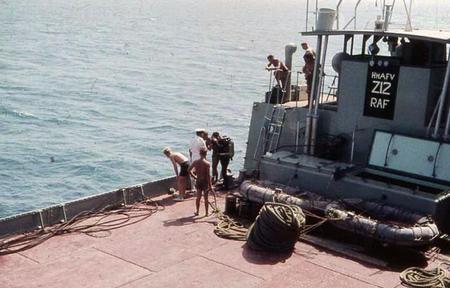 |
7. Dave Wheeler, Bill Powell and Bill Guthrie travelled by ship from Bahrain to Muscat. At the port of Dubai on the way, we witnessed an incident whereby the loading ramp fell off this Z craft during raising or lowering and sank to the bottom. Hence the need for the diver to go down and fix ropes to pull it up. | 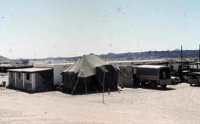 |
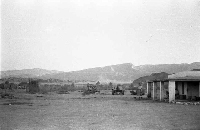
8. A view of 1 Troop’s barrack block and MT park at Nizwa Camp. The tent was the MT office and spares store. On the left is the newly-built technical office. |
||||
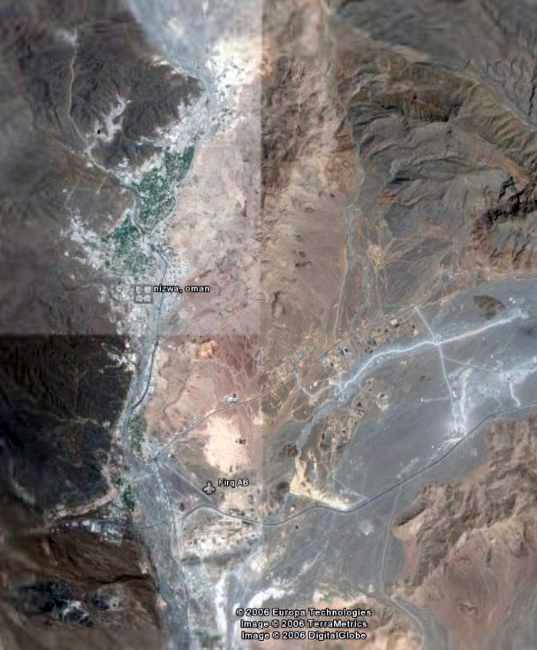
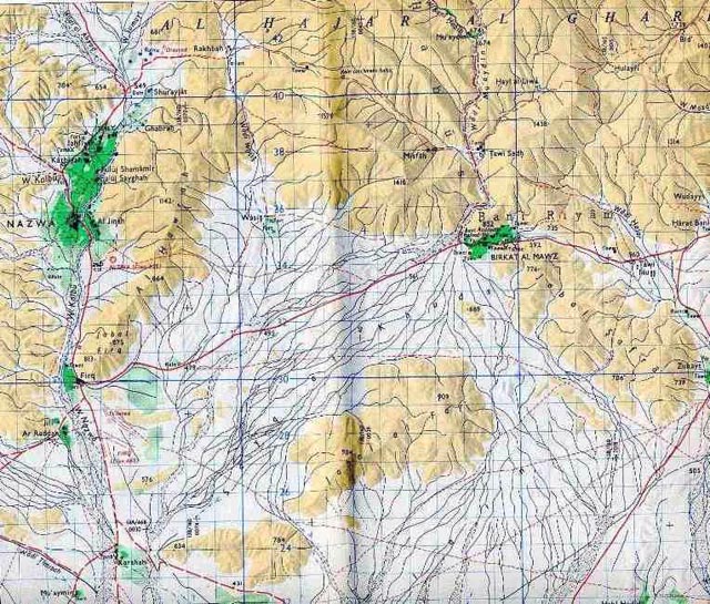
Nizwa camp and township |
|||||||
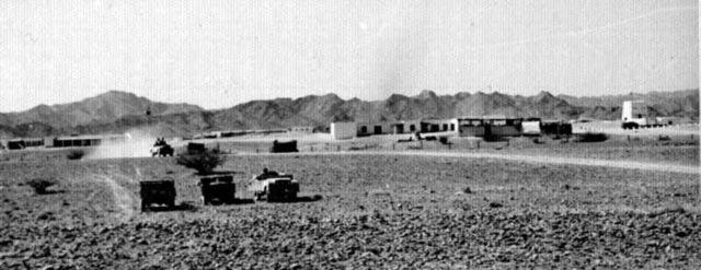 |
55. General view of No. 1 Troop’s quarters in the Sultan of Muscat and Oman Armed Forces camp at Nizwa. | 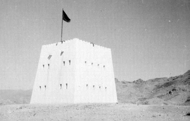 |
56. Guard tower, also visible on the right side of the previous photo. | 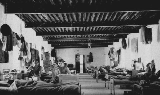 |
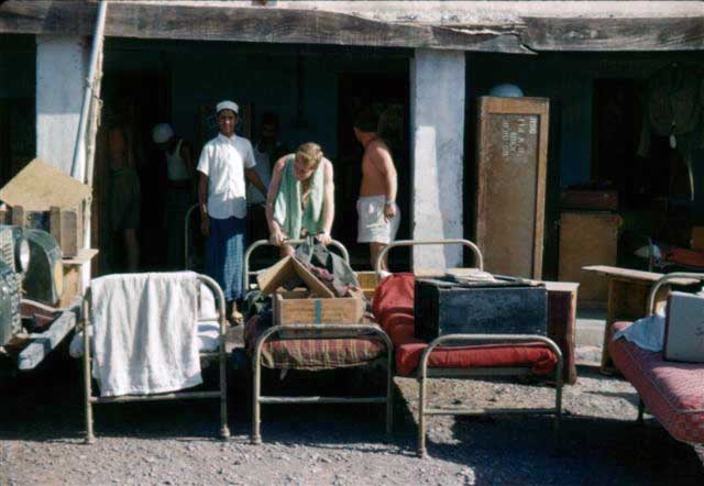
57. N° 1 Troop dormitory at Nizwa camp. On the left, drivers Ron Cunningham & Terry Gomersall relax during time off. The office was beyond the door visible at the end of the room. |
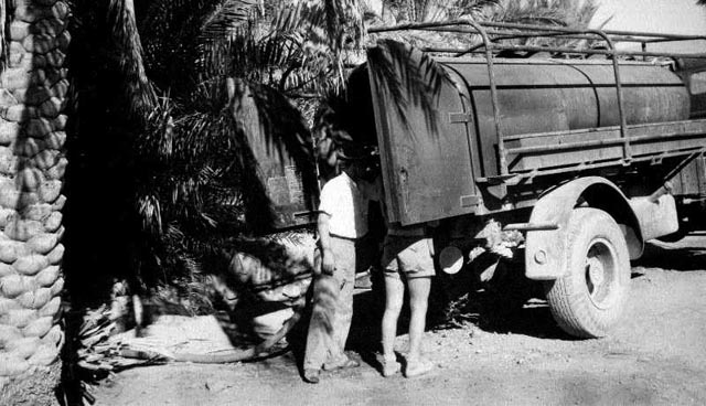 |
59. Filling up the water truck in Nizwa. |
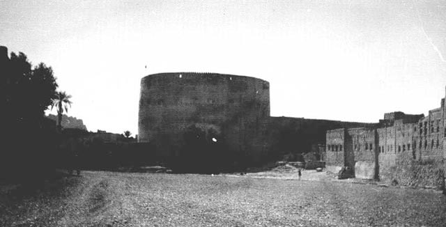 |
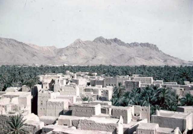
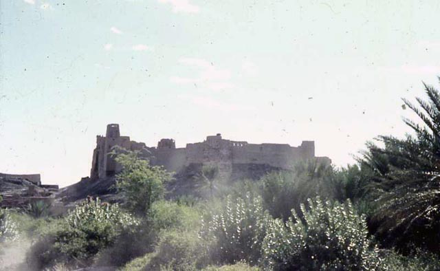
58. Nizwa town main street and fortress. | 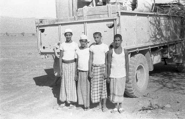 |
89. Four youngsters from Nizwa who worked as kitchen hands. From left to right: Ali bin Masood - ???? - Yaqum bin Said - ????. |
 |
88. The building is the end of the cookhouse. | 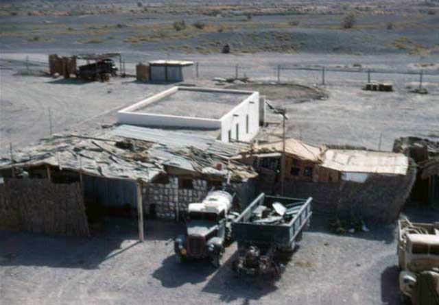 |
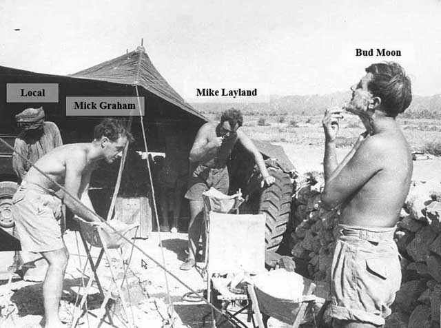
15. The cookhouse building with the coldstore and makeshift ‘club’ for recreation (boozing and bawdy songs!). Note the wall made from petrol and kerosene flimsies. |
 |
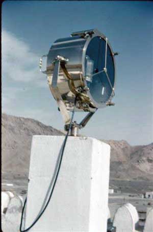 |
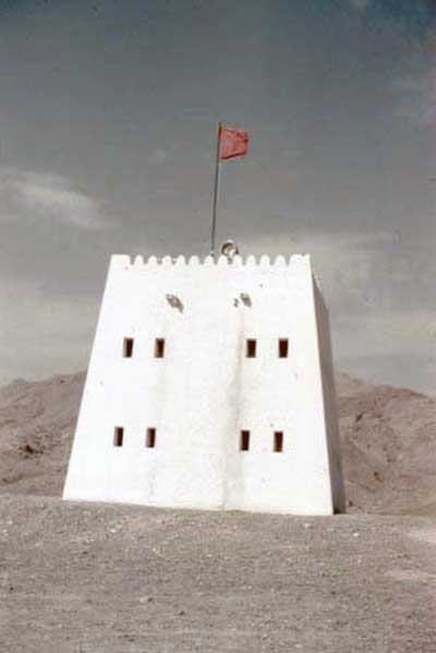
17/18. The watch tower and the searchlight. | 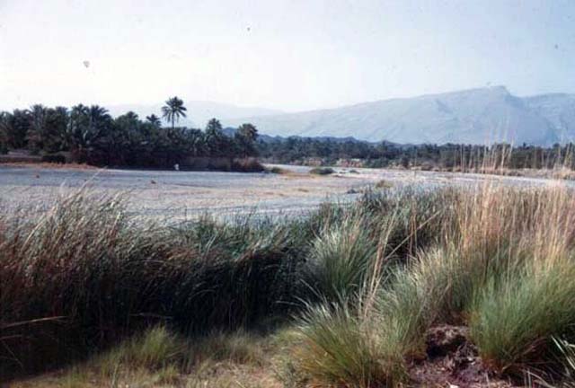 |
21. A view towards Nizwa from across the wadi, near where we built a dam for a swimming pool. | 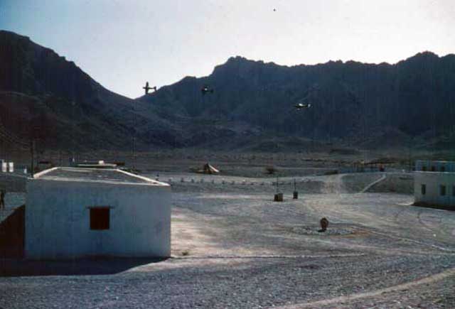 |
19. Some S.O.A.F. planes ‘buzz’ the Nizwa camp sometime during 1961. | |
 |
24. Looking towards the camp from the roof of Nizwa town fortress. The camp guard tower can just be seen above the palms at centre-left. | 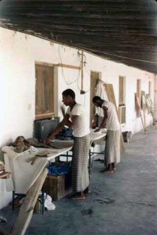 |
13. Dhobi Wallahs. | 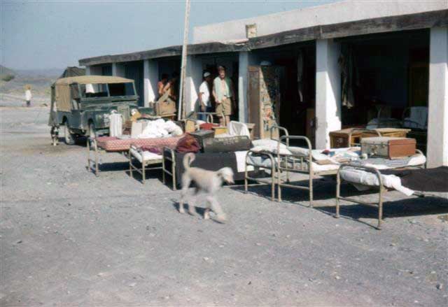 |
22. |  |
23. |
 |
26. |  |
27. Someone tries out an Arab weapon. | ||||
Out and about 1959 |
|||||||
 |
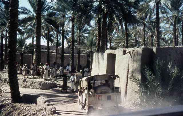
11. This photo was taken in September 1959 but I can’t remember exactly where. I imagine they were at either Nizwa, or Firq or possibly Izki (alias Ziki). |
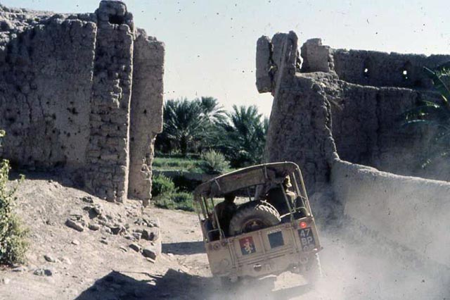 |
9. Once more unto the breach, dear friends! Will we get through before the walls come tumbling down. |
 |
10. Have the local villagers come out to greet us with open arms? What do you think? |
||
Our work in a nutshell 1959 |
|||||||
 |
5. The RAF flew the aerial photography in liaison with a RASLS unit which was also responsible for the ground control (astro fixes & triangulation). Photos measured 279 x 279mm and were flown at a height which, taking into account the elevation of the terrain above sea level, would give a scale of about 1:80,000. Thus each photo covered about 500 sq.km. Adjacent photos gave stereo cover (3-D effect) when viewed through a stereoscope. This aided enormously photo interpretation in the field. |
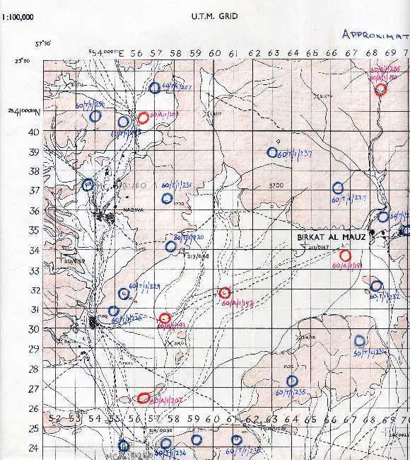 |
100. 42 Survey Engineer Regt. in Cyprus carried out the plotting and printing at 1:100,000 of the Preliminary Unchecked Compilation (PUC) sheets which were then sent with the photos to 19 Topographic Sqn. to do the field work. The air photos and PUC sheets were field annotated to show towns and villages, tracks and wadis, altimeter height-point and names-sheet reference numbers. This PUC sheet was used for referencing height points whose elevations were determined by theodolite observations (in blue) and altimeter (in red). The precise position of each point was identified on the relative air photo and pin-pricked, with its reference number written on the back. Annotation (description of features) was usually done on the relative PUC rather than on the back of the air photo for obvious practical reasons. |
||||
 |
103. Satellites and the GPS have revolutionized land survey mapping even more than the advent of the E.D.M. (Tellurometer etc.), the computer (calculations and C.A.D.), and Total station instruments (electronic self-reading and recording theodolite with EDM combined), all of which were exciting and effort-saving developments in the survey field. I have welcomed and greatly appreciated all these technological advances and I think their utility is even more enhanced by the fact that I have the satisfaction of also having done survey ‘the hard way’. (What would our forebears from the Survey of India say?) | ||||||
 |
38. The finished product, produced by 42 Survey Engineer Regiment. The detail area of each Preliminary Unchecked Compilation 1:100,000 sheet was about 510 x 370 mm, which means that it covered an area of about 51 x 37 km or 1,887 sq.km. Given that the area of the Oman is about 309,500 sq.km., there would have been about 164 sheets for total coverage, although I don’t know if there was in fact total coverage. The number of photos covering each PUC sheet, allowing for a 60% longitudinal overlap and a 25% lateral overlap, was about 24. Of these, some covered two or more adjacent sheets and so the average number of photos per sheet would work out at perhaps 18. The total number of photos to cover the Oman would therefore be about 164 x 18 = 2952. This seems quite a reasonable estimate. |
||||||
Ash Sharqiya Field party October 1959 |
|||||||
 |
61. Base camp in the Sharqiya, our home for a month or so. | 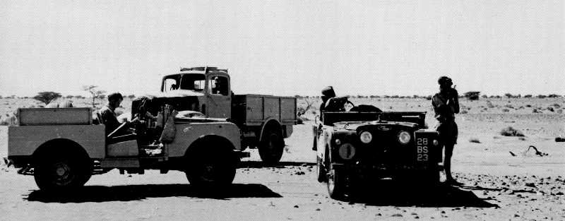 |
68. Out surveying on the sand and gravel plains | 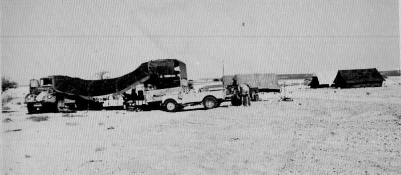 |
66. Base camp in the Sharqiya, our home for a month or so. | 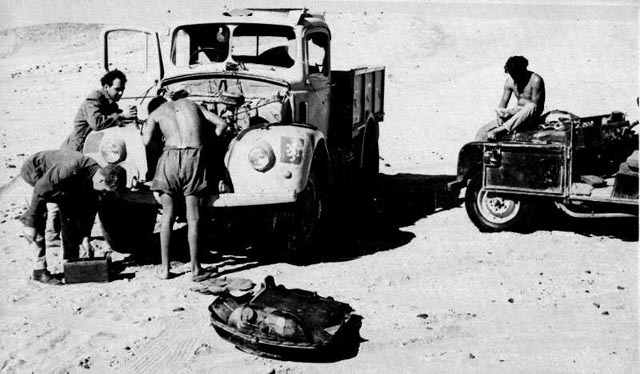 |
60. Field repairs to a Morris one-tonner. |
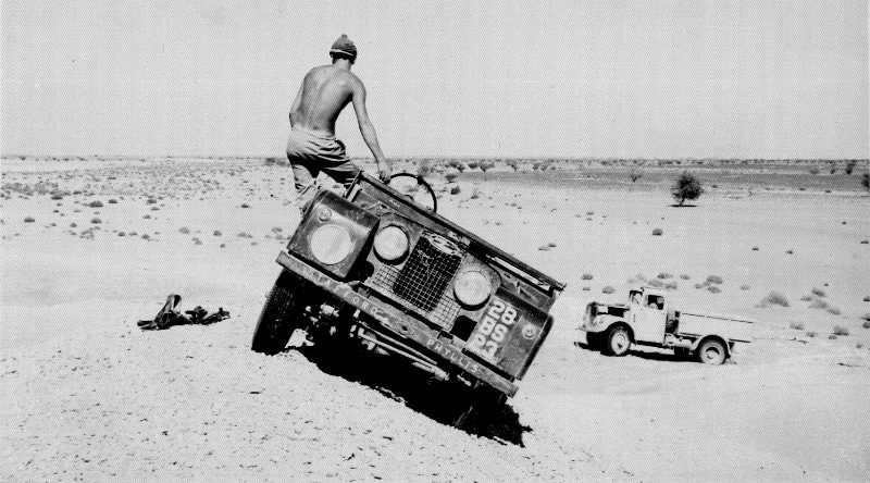 |
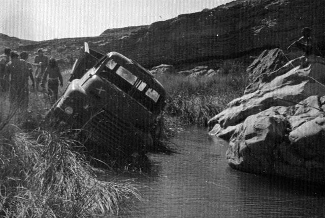
64. A spot of bother on a sand dune. | ||||||
Part of Dave ‘Streak’ Hobson’s diary - November 1959 |
|||||||
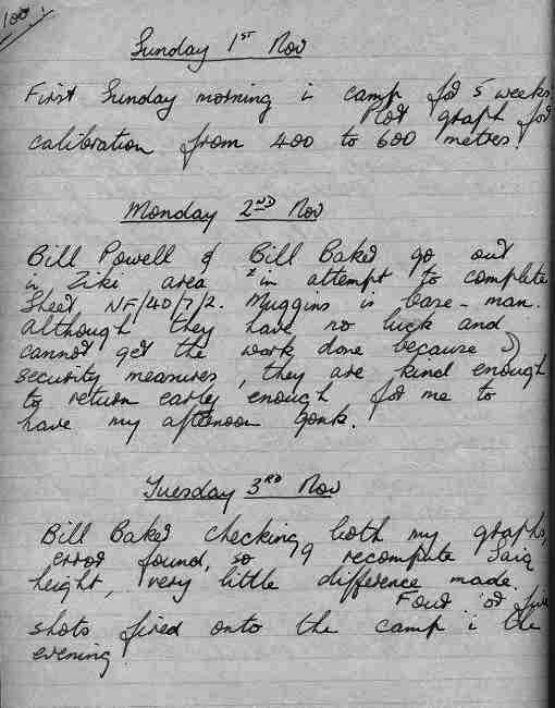 |
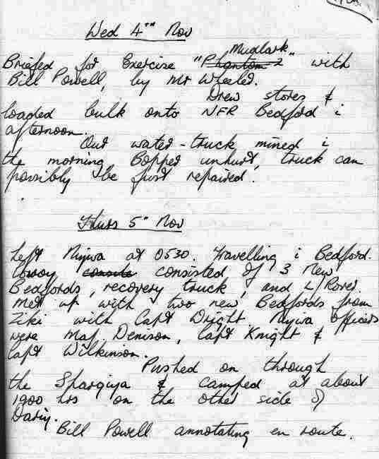 |
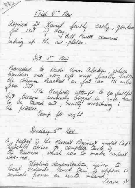 |
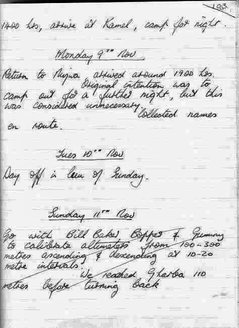 |
||||
Nizwa - 1960 |
|||||||
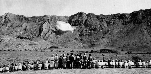 |
74. Nizwa – Some of the local population watching a demonstration of firepower by the Sultan of Muscat and Oman Armed Forces firing mortars at the nearby hills. Amongst them may well have been some of those who laid the mines which blew up our vehicles and who occasionally fired shots into the camp under cover of darkness. | ||||||
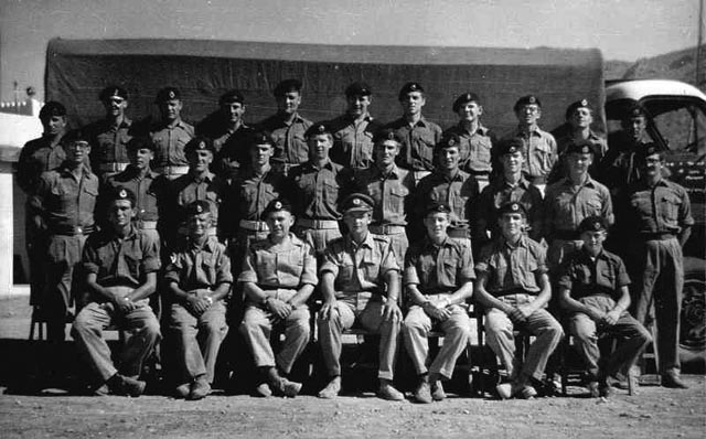 |
72. N° 1 Troop, 19 Topographic Squadron, NIZWA, Oman – February 1961 Back row: Taffy Richardson, Duddy, Dixon, Dave
Ford
surveyor, Partington
driver, Taff
McArthur, Dave Clifton surveyor, Sleepy
Heron
cook, A.W.H.
Robinson
surveyor, Mick Bracken
surveyor, Jock Wilson
driver Missing from this photo, amongst others, are Andy Anderson (on R&R in Kenya) and ‘Taffy’ Williams. Spr. William Dougal ‘Mac’ McDougall from Dunoon who was killed just a few days later when the Land Rover in which he was travelling was blown up by a mine not far from Muscat and Taffy Williams, the driver was injured Names supplied by Bob Kime, Alex ‘Jock’ Johnstone and Dave ‘Streak’ Hobson |
||||||
Miscellaneous |
|||||||
 |
71. And the driver wasn’t even drunk! | 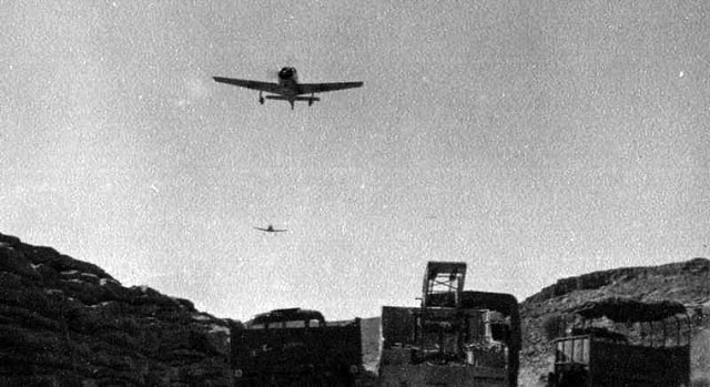 |
70. Two planes from the Sultan’s Armed Forces fly over to check on our wellbeing. | 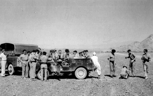 |
73. February 1961 - 1 Troop turns out in force at Nizwa (Firq) ‘International airport’ to say farewell to Dave Wheeler, Bill Powell and Bill Guthrie as they leave for Bahrain en route for the United Kingdom. | 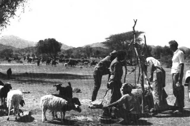 |
96. The Al Batinah coast March 1961 Watering a herd of goats at a well. |
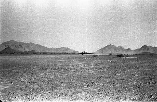 |
90. 1961. A GULF AVIATION DC3 lands at Firq ‘International’ Airport, near Nizwa. ‘International’ because it was used by Englishmen, Scots, Welsh, Irish (including Ulstermen), an occasional Aussie, Arabs and several other nationalities. The airport (landing strip) facilities were as you see them! | 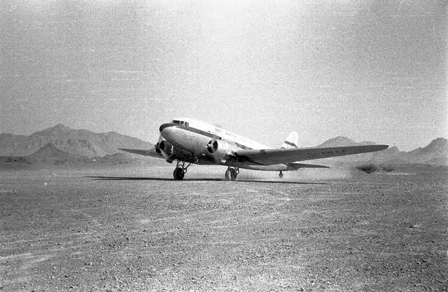 |
91. 1961. | 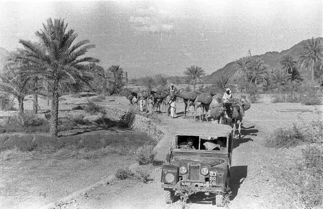 |
92. Modern transport ahead of the more traditional means.
At least the latter didn’t get mined. |
||
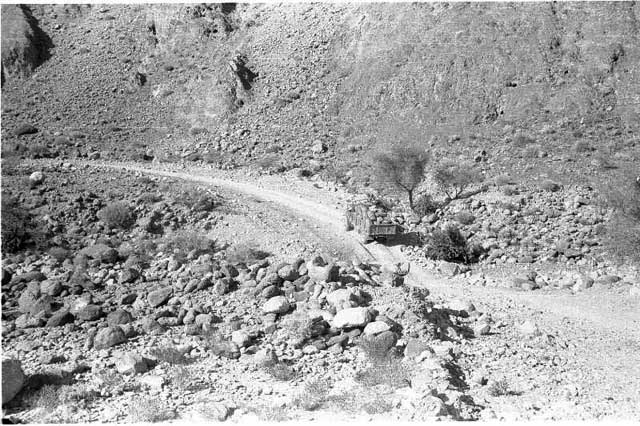 |
93. A heavily-laden three tonner (army or civilian?) wends it weary way along the dirt road. Where exactly? Now there are asphalted highways in the Oman and highly developed and landscaped towns.
What a difference the finding of oil has made. |
|
|||||
 |
101. Oman 1958 - Morning ablutions. This photo was taken at Nizwa, where our detachment, having originally come from 1 RASLS in Cyprus, was camping with the 15/19th Hussars. We arrived there in early May 1958 after a stint in Aden. Capt. Mills and Roy Isherwood were in charge. We were working on aerial photography control for the 1:100,000 mapping of the Oman. |
||||||
Some of N°1 Troop’s mined vehicles |
|||||||
 |
76. A Bedford RL 3-tonner after hitting a mine. The driver, Spr.Bill Guthrie was blown out through the observation hatch in the roof and suffered a broken ankle. | 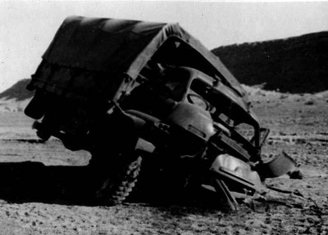 |
77. A Bedford RL 3-tonner after hitting a mine. The driver, Spr.Bill Guthrie was blown out through the observation hatch in the roof and suffered a broken ankle. | 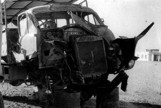 |
78. Mined vehicles ……waiting for repairs. | 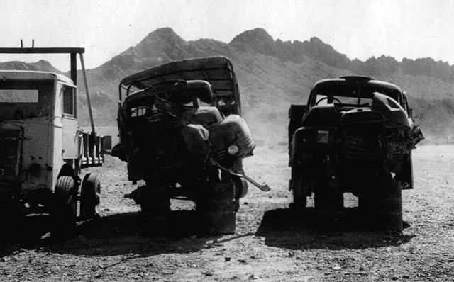 |
79. Mined vehicles ……waiting for repairs. |
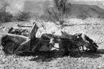 |
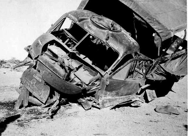
82. The remains of the Land Rover which hit a mine at the end of February 1961.
Spr.Dougal McDougall was killed and Spr.‘Taffy’ Williams injured. |
||||||