A Brief History of 19 Topographic Squadron
EARLY YEARS
FORMATION
On March 26th 1827 a Royal Warrant was signed to augment the Royal Sappers & Miners by three companies. This enabled three existing companies to be sent overseas, one to Bermuda and two to Canada for employment on the Rideau Canal. One of the new companies was the 19th Service Company which was raised at Woolwich. It moved to Chatham in 1829 and remained there two years. At that time its strength was one colour sergeant, two sergeants, three corporals, two second corporals, seventy privates and two buglers.
BARBADOS
The company sailed for Barbados in 1831. On the llth August of that year the island was hit by a severe hurricane which caused the loss of 2500 lives, 5000 wounded and damage to the extent of I million pounds.
Colour sergeant Harris distinguished himself during the rescue of men from the hospital which had been destroyed by the hurricane and he was shortly after to execute the first recorded destruction of a sunken wreck by submarine mining, an account of which is recorded in the following letter which he wrote to Colonel Pasley.
"The Arethusa was a ship of 350 tons, and went on shore in the hurricane of the 10th of August, 1831, close to the commanding Royal Engineer's Quarters at Barbadoes. I had orders from Major, (now Colonel) Reid, to try to blow her to pieces, which was done in the following manner. Two 01d oil tin cans, which held 30 lbs. each, were filled with powder; 1-inch hose was then made with. calico, filled and put through 1:-inch lead pipe, which was then soldered to the tin cans. The ship lay on her larboard side with the keel about 2 feet out of the sand, and at low water, (which was about 3 feet deep on the outside of the ship, the side nearest the sea), we put one of the cans under her keel, about 10 feet from the stern, and brought the end of the pipe through the side of her, as it was the best place for firing. When it was high water, it was about 6 or 7 feet deep, and we then fired the charge, and made a hole in her about 10 feet long, and upon an average 4 feet wide, through her keel, planks, timbers, and lining, and carried a piece weighing nearly 100 lbs. to a great distance. The next charge was put under the keel the same way, about half way from the hole just made to the bow, and that load had also a good effect, but it did not carry away so great a piece as the first. The next was loaded in the same manner, but with only 24 lbs. of powder, that was put under her keel as before, but near the bow: this load did not carry off a great deal, but shook her much. We then got the lining off the bow; there were 5 knees or timbers still remaining, which held the ship together; we put a sand-bag on the lower one of the five, containing 24 lbs. of powder: the explosion of this broke the beam it rested on and the two above it: we put nothing against it, only a bit of wood, to keep it in its place before it was fired. The next charge contained the same quantity, and was put on the lowest one of the two that remained. When that was fired, the bow dropt in pieces: the stern was done in the same manner as the bow, and every load that was fired had the desired effect: one or two missed, in consequence of the water getting in the cans.
(Signed) JOSEPH HARRIS
Late Colour-Sergeant, Royal Sappers and Miners.
Colonel Pasley, C. B. Royal Engineers."
Major Reid had served under Colby on the Survey of Ireland incidentally.
In March 1832 the 19th Company was re numbered the 15th and the number 19 was not used again until 1848. ORDNANCE SURVEY
On 1 April 1848 the 19th Company was raised for employment on the Ordnance Survey of Great Britain. The Royal Warrant was not however signed until 22nd August 1849. The establishment was one colour sergeant, four sergeants, five corporals, five second corporals, two buglers and eighty three privates. Rates of pay in June 1849 were:
|
Rank |
Regimental Pay |
Survey Pay |
|
|
Sergeant Major |
4s 7½d |
4s 0d |
|
|
Colour Sergeant |
3s 3½d |
2s 9d |
4s 0d |
|
Sergeant |
2s 9½d |
2s 1d |
3s 0d |
|
Corporal |
2s 3½d |
1s 4d |
2s 10d |
|
Second Corporal |
1s 11¾d |
1s 4d |
2s 6d |
|
Private |
1s 3½d |
1s 0d |
2s 6d |
At that time men for the survey companies were trained at Chatham before being transferred to Southampton. In 1849 the total Military., Force of the Ordnance Survey was 12 Royal Engineer officers and four companies of Royal Sappers and Miners totaling 332 men, and a civilian force of 583 assistants and 344 labourers. The importance of the military element at that time was paramount, the civilians serving, so to speak, as the "muscles for the military skeleton." Control of all operations was under the Military Act and Articles of War. Every party, however small, was in the charge of a NCO or private who was responsible for the work executed.
The Company originally worked at Liverpool but in the next thirty years it moved constantly to such places as Doncaster, York, Glasgow, Perth, Inverness, Bristol, Edinburgh and finally Southampton where it was largely based until 1929. It should he explained that the men of the companies were deployed in small sections each of a strength designed for a particular task and with an appropriate level of command. Temporary offices were hired in towns convenient to the current survey in which field work was drawn up prior to despatch to Southampton. In the early days the main employment was on the secondary and tertiary triangulation and the detail survey of the northern counties and Scotland. Special divisions were employed on levelling, triangulation, boundary perambulation, contouring and hill shading.
The first recorded fatality in the Company was in 1854 when "On June 9th of that year Private Richard Pemble, working from Elvanfoot in Lanarkshire, was sent to build a pile for trigonometrical purposes. The weather was stormy and the next evening, after a fatiguing days work, he lay down to rest himself by the side of a mountain stream and perished".
On the 17th October 1856 the Corps of Royal Sappers and Miners was granted the title of Royal Engineers. It was announced in the London Gazette thus:-
"The Queen has been graciously pleased to direct that the Corps of Royal Sappers and Miners shall henceforward be denominated the Corps of Royal Engineers."
The separation of the officers and men into two distinct corps under separate titles had long been felt to be an anomaly. It spoke wonders for the good sense and fidelity of the Sappers and Miners that they were, under such circumstances, so loyal to their officers. Officers and men who had long considered themselves one Corps were at last recognised as such. From this date the rank and file were no longer termed privates but where henceforward called Sappers.
In 1869 survey training carried out at Chatham extended to 154 clays for officers and 180 clays for NCOs and sappers of the Survey Companies. The courses for soldiers embraced all the operations of practical surveying including chaining, observing angles, traversing, calculating areas, levelling, contouring, reduction of base lines, protracting angles and triangulation.
THE BOER WAR 1899 - 1902
At the beginning of the Boer War the only maps available to the Army were a general map of Cape Colony and an obsolete map of Natal. Arrangements were made to improve and add to these maps and the survey companies were called upon to provide the manpower. Personnel from 19 Company were therefore very likely involved in the Boer War. Four sections were raised and sent to South Africa but two arrived after active operations had ceased and were employed on surveys of battlefields for historical purposes. The first two had been employed in Cape Town, Bloemfontein, Kimberly and Pretoria. In all about 463,000 maps were published of which 308,000 were issued to the troops.
WORLD WAR I 1914 - 1918
On the outbreak of war the manpower of the survey companies was distributed throughout the army. Approximately half of the men from 19 Company formed 46 Advance Park Company the remainder joining various other Royal Engineer units. The 46th Advance Park Company served throughout the war in the Middle East as a support unit of the Egyptian Expeditionary Force and was commanded by Captain C. E. Wyncott, who was promoted to major in 1918. The Company was based for most of the time in the Suez Canal 7.one and was responsible for receiving, holding and despatching a whole range of stores as well as the overhaul and salvage of materials and the maintenance and supply of machinery to the EEF. A heavy commitment was the fabrication of well drilling equipment and water supply. An illustration of the size of the EEP requirements is that 70,000 tons of stores were despatched by the company in the first six months of 1917.
The supposition that France was well mapped, and which resulted in the release of survey manpower at the beginning of the war, was, of course, soon dispelled. France had been mapped on a departmental basis with many independent grid systems. Consequently, the requirement for fixation of gun positions, and counter bombardment work using flash spotting and sound ranging techniques, resulted in a resurgence of Survey units and by the end of the war each Army had its own Survey Battalion. Strenuous efforts were made to trace the military surveyors and undoubtedly many found their way back into survey units.
A war establishment was fixed for the 19th Reserve Survey Company, RE at Southampton. "This Company included the instructional staff, the officers and men under instruction, those trained and ready to go overseas, and those employed on indispensable military duties". The strength was 14 officers and 163 other ranks. An element of this Company was employed in Dublin which suggests that the establishment was effective in 1916, since there is on record a GOC's order to the OIC Ordnance Survey to make arrangements for the issue of maps at any hour of the day or night during the Sinn Fein Rebellion of 24th April 1916. Later both the military and civilian staff were commended, including Sergeant Major Johnson.
THE NORTH RUSSIAN EXPEDITIONARY FORCE 1918 - 1919
A military mission was formed in 1918 to move to North Russia. Its aims were to prevent the vast stocks of war material there falling into German hands, to deny the use of the Arctic ports to the Germans and to assist the Russians in the training of new forces which might support the allied effort. Approximately 600 men sailed for Murmansk on 16th June 1918 and from then until 27 Sep 1919 41 officers and approximately 1000 men were killed.
Three NCOs of the 19th Company were selected to undertake mapping and survey work in support of the force. Sergeant Major Wilde, who %vas in charge, found some local plans in offices of various government departments to supplement the poor small scale existing mapping and enlisted the help of some Russian surveyors. Three mapping sections were formed and trained by Sergeant Major Wilde and Sergeant Matheison, while Sergeant Bristow took over the running of the main map office. The work included the production of some large scale maps of defended localities and minor triangulation with beacons frozen into holes in the snow and ice.
THE INTER WAR YEARS
THE ORDNANCE SURVEY
With the return of peace the 19th Company resumed its duties with the Ordnance Survey based at Southampton. Personnel were still given basic military training at Chatham in the Training Battalion RE. On completion they were posted to Southampton for a short drawing course, then to Bristol for a detail survey course prior to employment in one of the survey field offices at Edinburgh, York, Bristol, Norwich and later London.
Continuation training in the military skills was carried out on a triennial basis often at Fort Bembridge on the Isle of Wight in the summer months, and survey training in trig, topo, astro and some air survey was done on an annual basis. Correspondence courses in trig computing were introduced and repro training was carried out at Southampton.
Employment in the inter war years was largely on the revision of the 1:2500 plans, the technique mainly employed being the simple graphical revision of map case mounted traces using "eyeball" and simple measuring techniques. Teams were also employed in the levelling division, which was organised from Southampton, and on trig duties including trig point restoration and later, the retriangulation.
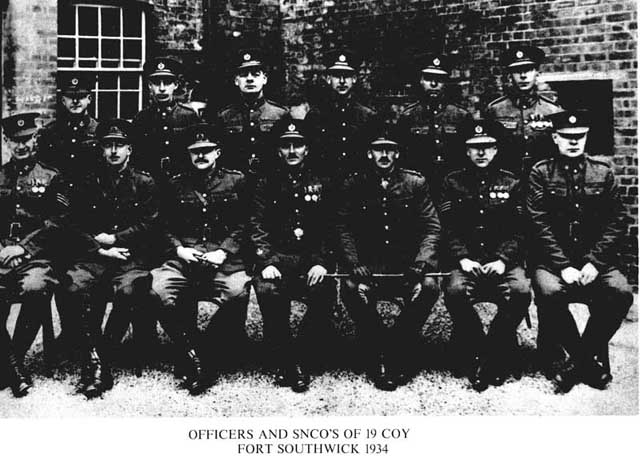
Training at Fort Bembridge ceased in about 1927 and in 1929 personnel from the Survey Companies were absorbed into the Survey Battalion. However in Dec 1931 authority was given for the formation of 19 FieldSurvey Company which was to be the training unit for military personnel of the Survey Battalion. It formed up in Fort Southwick, near Fareharn, in July 1932 under Major F.O. Metforcl. Repro training continued at Southampton where the machines were located. In 1939 the Company was swamped with recruits, and in 1940 the responsibility for training was undertaken by the Survey Training Centre at Ruabon. On Mobilisation 19 Company reformed at Fort Widley as 19th (Army) Field Survey Company RE. Some of the trained manpower was taken from the Company to help form up and expand the three Corps Field Survey Companies, 13, 14 and 514 at Fort Southwick. 19 Company was to have an eventful war which is recorded in some detail.
BOUNDARY SURVEYS & COLONIAL SURVEY WORK
The employment of the Survey Companies in the Ordnance Survey of Great Britain coincided from the early days with the period of imperialist expansion which led to the continual requirement for boundary commissions and surveys and later colonial surveys for mapping purposes. Then, as now, work overseas was often carried out by small self administering independent parties, the men being selected by virtue of their skill and suitability and thus coming from any of the Survey Companies. Many of the surveys undertaken are documented in the History of the Corps of Royal Engineers and Royal Geographical Society Journals, however there is now no way these surveys can be definitely attributed to any particular company even when names of personnel engaged upon them are known. If suffices to say that many of the surveyors in the company must have been employed on this work from the earliest days to the Second World War period.
WORLD WAR II
FRANCE 1939 - 1010
The 19th Fd Svy Company was amongst the first survey units to mobilise and move to France with the BEF as a GHQ Troops unit. At this time the Survey order of battle was:-
GHQ Survey Directorate 19th Fd Svy Coy
I Corps Survey Directorate 13 Fd Svy Coy
II Corps Survey Directorate 14 Fd Svy Coy
III Corps Survey Directorate 514 Fd Svy Coy
The 19th Coy consisted of a mobile echelon of four topographical sections for field survey work and an immobile echelon of drawing and reproduction sections which were equipped with photographic plant and six double decay static printing machines.
The first echelon with four topographic sections and HQ embarked for France on the 13 Sept 39 under the command of IA Col R. LI Brown and moved to an assembly area near Le Mans. Personnel of the Company were first employed in assisting in the receipt of maps at the railway and the setting up of a Fd Svy Depot at Le Mans. The opportunity was also taken to re-cast the trig records of Northern France and Belgium to make them consistent. This was successfully clone, the French Service Geographique accepting the work and labelling it Nord de Guerre Anglaise. On the move forward to the concentration area GHQ and its various Services were scattered around the Arras area. 19th Company was joined by its reproduction section in early Dec 1939 and established Coy HQ computers and draughtsmen in a chateau at Prevent. A somewhat derelict saw mill was taken over and converted into a machine shop to house one single colour and one two-colour printing machines, proving presses, helio and vandyke and guillotine. Other buildings were taken over for camera installation, litho draughtsmen and photo-writers. Transformers were installed to step down the local power supply from high tension 13,000 volts to 440 volts. Unit Lister generators were erected as stand by power units together with an RE DC generator for DC equipment. After much effort a small scale map production establishment was set up which was to remain there until evacuation in May 1940 and which was to deal with a great quantity of printing work required by the various headquarters branches and the three Corps. Typical tasks undertaken by 19 Coy which worked full time from the moment its machines were installed until the evacuation were:
Stock printinof 1:50, 000 and 1:250, 000 sheets from duplicate reproduction material supplied by the War Office. Normally bulk stocks were shipped from the UK but there were occasions when large urgent issues had to be made. Revision of GSGS 4040 1:50, 000 and GSGS 4041 1:25, 000 sheets including road revision within the British zone and revision of topographical detail. Air photos were used. Revision traces prepared by drawing sections were returned to UK so that revision could he carried out on original material, kept in the War Office, by the Ordnance Survey.
Special Mapping of the R Dyle Position in Belgium Special mapping was prepared to enable the British Troops to move forward to a defensive position on the R Dyle, east of Brussels, in the event of a German offensive. Various overprints, route diagrams, administrative traffic maps and town plans were produced. A special series of layered 1:50, 000 maps was issued for the actual defensive positions along the R Dyle.
German Defences on the Siegfried Line
French mapping was obtained and brought up to date for intelligence purposes.
Road Classification Maps
Maps for a GHQ (1) Report on communications in Belgium were prepared. Contradictory road classification information complicated the compilation task.
Eastern Belgium and Western Germany
In anticipation of an advance east into Belgium a programme was prepared whereby 19 Coy would photo reduce French zinc mounted 1:20, 000 sheets of western Germany to produce a 1:25, 000 series. Copies of French 1:20, 000 mapping were obtained and photo reduced to 1:25, 000 scale in connection with the despatch of British Divisions to the Saar. Due to haste no touching work was allowed on negatives, however results were excellent. Topo Work & Fd Svy Depot Assistance
On the move forward to the concentration area one topo section and Capt Harris had remained at Le Mans to assist in the move of the Fd Svy Depot to Rennes, its new location. This task took about a month. The CSM and about 20 other men had assisted in the setting up of the Fd Svy Depot at Rennes. On completion of this task the Le Mans party joined the Coy at Frevent.
The topographical sections were employed on check surveys of the French triangulation to test its reliability and to extend survey work wherever necessary to provide the RA Survey Regiments with any extra control they needed. 19 Coy worked in the rear areas behind 13 and 14 Goys. Several special tasks were undertaken:-Triangulation at Nantes
A section carried out a dense network of control covering the Nantes area for the fixation of AA gun positions. Computation was still in progress in May when operations prevented completion.
Supply Depot at Abancourt
A trig framework was observed as a preliminary to a survey of an area in which a large supply depot containing AA battery positions, a large railway regulating section and petrol and supply depots were to be positioned. Operations in May prevented completion.
Bombing and Field Firing Ranges at Dannes
A sketch map was prepared from air photos. Portions of perimeter boundary running through woods were surveyed and beaconed on the ground.
Aerial Photography of Training Area Photos of a training area were taken to assist in damage assessment after use for training. A large scale map was to have been made but was later cancelled.
Panorama Photography
An extensive programme was formulated for panorama photography to be taken from every pill box, on which ranges and bearings and fields of fire were to be annotated. After trials it was decided to use the Cirkut panorama cameras held in the unit in preference to Press cameras with telephoto lenses. One operator was attached to I and II Corps. Results were excellent and good progress was made. Films were processed at 19 Coy and proofs were sent back to Corps HQ for annotation within 24 hours.
Bilby Tower Training
All companies carried out training on the erection and use of three Bilby towers sent from U.K. in anticipation of possible requirements. It is reported that Lord Gort visited the Company and seeing a IliMy tower suggested that his ADC might climb one. Not surprisingly the ADC declined whereupon Lord Gort took off his jacket and climbed the tower.
Two single colour and two double colour Crabtree printing machines, a camera and other auxiliary plant were installed in an excellent factory building at Colombes (Parfumerie Kerkoff, Rue de l'industrie). Floors were strengthened for machine beds, dark rooms were constructed, installation of transformers and rewiring of the building took place. The men's sleeping quarters were to be on the top floor and the officers took over a private house next door. The equipment was moved to the site by rail and had just come into production when the German advance on Paris necessitated a hasty evacuation.
The German offensive was launched on 10 May 1940. One topo section went forward to Belgium where, it is assumed, it was to take part in revision and classification of roads in the BEF zone. The mobile party did not move into Belgium until the 15 May due to congestion on the roads caused by Corps traffic. It set up at Ellezelles but had done only one day's work when it had to withdraw, to Prevent, on 17 May. On this day OC 19 Coy had been ordered to set up road blocks around Prevent and to be ready to move at a moment's notice. All printing plates other small stocks and records were loaded onto trucks and consigned to the map printing establishment at Colombes on 18 May. These unfortunately did not get through and 19 Coy could not print from that date. In the rapid retreat which followed all the heavy equipment had to be left behind.
In the early afternoon of 19th May Commander GHQ Troops visited Prevent and ordered 19 Coy to move to the outskirts of Boulogne. That morning the one topo section which had been operating with 13 Coy in Belgium returned to Prevent. Mobile echelon and part of the immobile echelon, in impressed transport, moved to Boulogne. Coy HQ was loaded onto two trucks and all surplus stores and documents buried. Late that night the transport returned from Boulogne, the rest of the Coy loaded up and moved soon after midnight arriving at Foret d'Hardelot in the morning where it bivouaced. On the 2Ist 19 Coy, as directed by the Adj General in Wimereux, moved from the Foret d'Flardelot to Coppernaxfort to the south west of Dunkerque using its own transport. Those stores which could not he moved were dumped. On the 23rd an attempt was made to recover these dumped stores but enemy dispositions made this impossible. On this same day a further move was made to a village closer to Dunkerque. The main party embarked on the Dover Abbey at Dunkerque on 26 May 1940.
At Colombes, where 2 officers and 20 men were supervising the installation and construction work, some urgent printing of 1:50, 000 mapping was carried out using duplicate plates obtained from the Service Geographique in Paris. Eventually the establishment had to be evacuated on 10 June. The machines were dismantled and the personnel moved to Rennes. Final evacuation was on the 16 June, the party moving from Rennes to Brest where it embarked on the 17th, arriving in UK on the 19th. A reinforcement draft on its way to the unit never caught up and was eventually evacuated from Brest. CSM Murphy was taken prisoner when the train on which he was returning from compassionate leave was captured in the rapid advance.
In retrospect the organisation of 19 Army Pd Svy Coy had been most unsuitable for its purpose. It was unwieldy and in view of its size and the mixture of mobile and immobile echelons its command and control was difficult. Recommendations were later made in UK for Corps Pd Svy Coy reproduction plant to be mounted in self propelled trucks rather than trailers even at the expense of machine size, the double demy size being too big to fit a truck. However a 1:25, 000 sheet could just he printed on single demy. It was also recommended that at the Army 11Q the double demy should be retained in trailers which could be moved at short notice to cater for printing of the larger 1:50, 000 sheets.
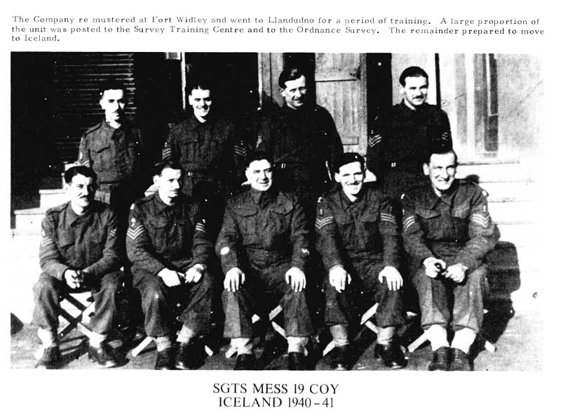
ICELAND 1940 - 1941
The evacuation of Norway in 1940 had left the enemy in control of the seaboard. To maintain sea communications between the United States and the United Kingdom it was essential that Iceland should not be occupied by German forces. In May 1940 a British force landed in Iceland and in conjunction with US Forces ensured its protection from German occupation. A much reduced 19th Coy, 100 strong, sailed for Iceland on 29 July 1940, on the Georgic under the command of Major R H Denniss RE. The Company consisted of:-
2 Topo Sections
1 Drawing Section 1 Printing Section
Its transport comprised I utility car, 5 motor cycles and 22 cycles.
Technical equipment was set up in a small concrete building used as a potato store and tented accommodation was later replaced by Nissen huts.
On arrival the guillotine, unpacked from two crates, was found to consist of parts from two different machines and so it could not be assembled. Graining marbles were soon used up and a resupply from UK arrived just in time to prevent a stoppage of work in the printing programme. Modifications to printing machine motors had to be carried out because the local supply voltage fluctuated. Unit generators had not been taken. Due to inadequacy of transport the RASC provided trucks whenever possible and this made progress reasonable.
Contact was made with HMS Challenger whose Cornmander provided a trig list which was to be the basis of all subsequent survey work. Initial work consisted of the fixation of gun positions and grid bearings for the guns. Survey and levelling was also carried out for the naval base and the airfield being constructed.
A plane table map at 1:25, 000 scale of Reykjavik in two sheets was undertaken, the task being eased by the provision of air photography flown by 701 Sqn of the Fleet Air Arm.
Danish mapping in the State Engineers office was obtained and two 1:100,000 map sheets of the east coast were printed. These were so well received that material for about twenty more sheets was provided by the State Engineer. Once settled in there was a steady demand for special maps, overprints, administrative diagrams and technical sketch maps. Among the mapping produced were:-
13 x 1:50, 000 sheets
5 x 1:250,000 sheets
1 x 1:1, 000, 000 sheet
A 1:5, 000 town plan of Reykjavik
The Coy left for home on the 13th April 1941. In its short stay it had, by its working achievements, and the cordial relations established with other units, won its rightful position as an essential and welcomed unit of the occupying forces, although there was in the early stages some doubt amongst the Force 1K) staff why a survey unit had been deployed and what its functions were.
NORTH AFRICA 1941 - 1942
On return from Iceland the Company reorganised at Beckhampton where it was billeted in one of the well known racing stables. It did no survey work but was employed on training and exercises. 'tle establishment was built up with new arrivals and some of the old hands from France. The Company was to remain substantially the same for the next three years. During its time at Beckhampton some senior non commissioned officers assisted in training the local Home Guard on Sunday mornings, all exercises finishing at the local either in Beckhampton or Avebury!
After a delay due to lack of convoy space the Company sailed from Liverpool on the Andes on 29 July 1941. They called into Freetown and then Durban before transferring to the Nieuw Amsterdam and continuing to Port Tewfik, where they landed on 20 September 1941. The long journey \vas completed by rail to Tura, a location at the foot of the Nile escarpment about 6 miles south west of Cairo. Work had already taken place in the Tura caves, quarries from which stone had been taken for the construction of the pyramids, to convert them into safe locations for printing machines, cameras, drawing offices and depot stores. Three machines were erected in September and 2 Depot's stores were also installed that month. 512 Company was to be based here for the duration of the war.
One topo section worked with the Eighth Army in the Western Desert with 512 Company and one set up a small forward map depot at El Adem. One of the drawing. sections was exchanged temporarily with one from 514 Company which is believed to have carried out large scale surveys at Iviat ruh. Another drawing section was exchanged with a South African Company which had been employed since July on the survey of forward desert tracks in the Western Desert, surveys of the Delta defences and 1:50, 000 scale mapping of the El Alamein area. During this period Spr Miller was captured at Tobruk and Lt Hayes was wounded and left the Company. The South Africans also provided a willing and cheerful detachment of Basutos from the Johannesburg area. This detachment later accompanied the Company to Persia.
PERSIA AND IRAQ 1912 - 1943
The revolt by the pro axis element in Iraq headed by Rashid Ali in 1941 prompted a British response to protect its treaty rights. An Indian Infantry Brigade and associated troops, about to embark for Malaya, were diverted to Iraq and landed on 18 April 1941. Although hostilities occurred the Iraqis asked for an armistice on 31 May. The German attack on Russia increased the importance of the Iraq-Persia area and German fifth-column activities prompted the allied occupation of port and oil facilities at Abadan and later the joint occupation of the country by British and Russian troops. Initial survey support to the Expeditionary Force was given by No 1 Indian Field Survey Headquarters and later Nos 1, 2 & 4 Indian Field Survey Companies.
The spring 1942 German offensive in the Caucasus made the invasion of Persia a real possibility, and defence preparations were increased. The Headquarters of the Mobile Echelon and 3 Topo Sections of 512 Field Survey Company RE and 19 Field Survey Company RE moved to Iraq in July 1942 to assist in the survey effort, coming under control of DD Survey in Baghdad.
At this time the Coy consisted of HQ, Repro Section, and 3 Drawing Sections. The 3 Drawing Sections moved first by rail. The 11Q and Reproduction Section followed on July 6th in unit transport via Jerusalem, Baghdad and Basra to Ahwaz, a journey of 1700 miles. A grain silo at Ahwaz was selected as a suitable building for a base printing installation and Ahwaz also met the requirements for security and good communications with Persia. Printing equipment moved by sea was set up and in operation by November and the early programme included the printing of reserve stocks of 1:100, 000 and 1:250, 000 mapping. Large stocks of paper had been brought from Cairo as an insurance against loss had the German drive into Egypt from Libya been successful. The climate at Ahwaz was extremely trying with summer temperatures rising to 130 degrees in the shade. The winter which followed was severe with thunderstorms and floods. Living accommodation was in tents and there was little in the way of recreational facilities.
Two members of the squadron died at Ahwaz of pneumonia that winter. I.Cp[ W Semple on 29 Dec 42 and Spr J L Fenner on 10 Jan 43.
Two other members of the Company died at Baghdad where the drawing section had been temporarily detached to the 4th Indian Survey Company. Spr E J 11 Wheeler died from heat exhaustion on 16 July 42 and Spr G A Grundy died from pneumonia three days later. They were buried at the small but beautiful British Cemetery in Baghdad.
The drawing sections originally worked with 4 Indian Field Survey Company in Baghdad. Later one section accompanied the whole of the air survey complement of the Indian Field Survey Companies to Ilamadan in July 1942 where, under the command of 4 Indian Field Survey Company, they formed an Air Survey Group. By mid March 1943 this group had completed about thirty sheets at 1:25, 000 scale of the defence areas in NW Persia besides other work at 1:50, 000 scale.
The Company had come under control of GHQ Survey Directorate which had been formed as part of Persia Iraq Command in September 1942. In November 1942 the two topographical sections of 19 Company left Egypt and joined in the increased programme of field control which had been started in October 1942 to extend the recent surveys eastward in the direction of Tehran and Nain, the work being mainly 1:250, 000 mapping. Certainly they were involved in the connection between the Iraq geodetic framework and the new triangulation in Persia, completing it in February 1943. Reference has also been made to them working in the mountains in the north in the Kharkeh River area where the OC, Major Mansfield, earned a high reputation as a shot while hunting with the nomads.
The whole of the allied survey effort in Iraq Persia had contributed to re- survey or revision of 120,000 square miles in Iraq and 100,000 square miles in Persia at 1:100,000 or 1:250, 000 or in some cases both scales. In Persia alone 2,500 miles of triangulation was completed. 19 Field Survey Company played its full part in these efforts in a country whose terrain varied from plains at sea level to mountains at 10,000 feet with temperatures from 0 to 130 degrees fahrenheit. However with the relief of Stalingrad in November 1942 the threat to Iraq and Persia had been removed and on completion of its field programme 19 Field Survey Company was ordered in April 1943 to return to Egypt. The prospect of another summer at Ahwaz had not been relished and the Company eagerly packed up stores and machinery. The move was made in several parties the last entering the Middle East on 22 May 1943.
Back Row:
Spr R A Barron, LCp1 I R McFarlane, Spr E WElston, Spr .1 McNie, Spr S A Cum, LCp1 J Owens, Pte M Yone, Pte M Motseki, Pte S Makhotla, Pte L Lechesa, Pte K Rantsopuoa, Pte L Makhotta, Pte M Maoutsoc, Pte R Leshotli, Pte M Pakela, LCpI N Qobosheane, Sgt T Matsoso, Cpl T Ramokotjo, Pte S Montsi, Pte D Nkekc, Pte RI Tsethe, Pte R Litupa, Pte M Mosia, Pte L Morallana, Pte I Sefali, Pte K Seochle, Pte Mphoke, Plc R Thamae, Pte S Ntsau, Pte M Moalosi, Pte P Lebakeng, Spr H Benent, Spr T H Jacques, LCp1 R C Broad-bridge, Spr W D Green, Spr E A Atkins, Spr B A Snook, Spr T R Morris, Spr W S Stacey,
Centre Row:
Dvr TT Adamson, Spr .1 A Dewar, Spr E Cox, Spr J C Burkett, Spr J E Heckraft, LCp1 C H Moore, Spr C Wilkins, Spr A A Shaw, Dvr A J Petto, Dvr E W Spr W A Duncan, LCp1 A J 01dinan, Dvr R II Mattocks; Dvr E R Bevan, Spr W L Moran, Spr A E Smith, Spr P .1 Thornton, Spr E Smith, Spr L H Horscroft, LCp: R Maise, Spr T W G Flatt, Spr G Ii Sales, Spr J T Stanley, Spr R L Pitts, Spr S D Davies, Spr C 1' F Harris, Spr R T Briggs, Spr R J Lewis, Spr K E Jessup, Spr D D Olphcrt, Dvr R A Wickes, Dvr W Sergeant, Dvr 11 Cooper, Spr D A Williams.
Front Row:
Cpl 1)11 House, LCp1 A B Barry, Cpl S Lawson, Cpl C W Sturges, Sgt I' A IluAiss, Sgt B Edwards,
Sgt L P Cooper, LSgt 1) R Taylor, Sgt J T Ilandyside, SSgt A J Jones, CQMS M Heathwaite, I,t NI R Mullins RE, Lt R D Parry RE, Capt R Urry RE, Maj F Q Mansfield RE, Lt C Rostron RE, Lt R Bowen 1E, CSM G Bishop, SSgt A M Oldham, Sgt J Francis, LSgt E Hutchinson, Sgt J A Mumbray, 1,Sgt 3 Frampton, Sgt W J Stark, Cpl A Pearson, Cpl W ll Radnedge, Cpl A C Hayter, Cpl F A Kay-, Cpl C V Wagstaff.
Kneeling:
Spr A 11 Hayes, Dvr A E Roberts, Spr .J Jackson, LCp1 W J Jones, 1,Cpl E I Williams, 1_,Cp1 R 11 Johns, Spr A Dickson, LCp1 J B K Grover, Spr W F Bradley, Sur W T Craddock, ,Cpl J D Henderson, .Dvr G H Middleton, Spr A K Pearson, Spr D Paine, SprM M Maurin, Spr L W Muller, LCpI R Watson, 1,Cp1 F Heard, Sur W II B Spr V A Willstead, Spr R A Field, Spr F Poole.
Sitting:
Spr C J Robinson, Spr F Baker, Spr C H Bradfield, Spr E W Plunkett, Spr C 11 Cliffe, Spr S Felton, Dvr .1 F Mordan, Spr K C Bridger, Spr F Bowers, Spr F 1! Hassan, LCpI.W Jackson, Dvr F C Laker, Dvr J. Paul, Spr D Douglas, Spr E Cronin, LCpI Tiley, Spr N Kirby, Spr K J Jardine, Spr W .1 Miller, Spr J A Dyke, Spr C Weeks, Dvr D D Newman, I.Cp1 J C Crawford, Spr A P Roach.
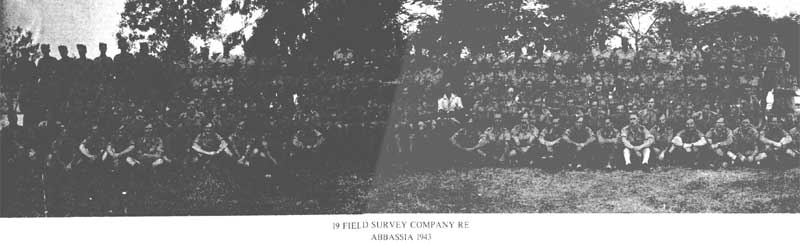
NORTH AFRICA 1943 - 1944
On return from Iraq the Company set up at Abbassia near Cairo. March and April were busy months of intensive survey work in preparation for all possible future operations in the Middle East. The company worked hard on the revision of mapping of Sicily and Italy in preparation for the invasion of Europe. The topo sections were employed in coding maps for the Sicily campaign and the printers were particuarly busy producing large quantities of charts for the air forces bombing Europe. Printing output of the survey units concentrated at Abassia was 2 million maps in May and 4 million in June.
ITALY 1944 - 1945
The invasion of Italy took place on 3 December 1943. The Company commenced its move to Italy on 1 February 1944, sailing from Port Said to Taranto in HMTS Dilwara, arriving on 8 February. The next move was by train to a transit camp at Naples and finally the Company set up in Arzano "where the smells rivalled the Middle East". The Company had a grandstand view of the eruption of Mt Vesuvius on 18 March. Rome fell on 4 June 1944 and the Company moved again, this time setting up in a film studio at Ponte Milvio on the outskirts of Rome.
The Company was then brought under direct command of Allied Forces Ileadquarters to carry out important work in preparation for Operation Dragoon, the invasion of southern France. Work in July and August in support of this operation included the production of special overprints, going maps, beach panoramas, layering of 1:50, 000 mapping and Gee lattice radar charts for control of aircraft. The Company's efforts were later to earn a commendation from General Patch of the US Seventh Army.
During its stay in Rome the OC, Major Mansfield, left the Company to go to the Middle East after three years in command. His place was taken by Major J R Hyatt. On 29 August 1944 the first party to be repatriated left the Company after five years overseas. They were 31 men who had been with the Company since it embarked with the BEF for France in 1939. By the end of 1945 the remainder of those who had embarked in 1941 became due for repatriation and the Company underwent a great change. The war ended while the Company was in Rome.
THE POST WAR YEARS
AUSTRIA & ITALY 1945 - 1947
The end of hostilities was not the end of 19 Company's travels. In August 1945 Major A J Herbert assumed command and preparations took place for a move to Austria. Once again stores and machinery were packed and on 1 September 1945 an advance party left Rome by train on a four day journey to Austria. The main party followed by road on 2 September. A small, modern but war damaged factory at Simmering on the outskirts of Vienna was to be its base for the next nine months. On arrival it was found that the roof leaked, the windows were blasted and many walls were down. Printers became steeple-jacks, draughtsmen took up trowels and topo surveyors found themselves tinsmiths. Repair work on this self help basis went on through October and production work started in November. Apart from some routine map reprinting the unit printed everything from posters to official forms for HQ British Troops Austria. While in Vienna the Company was issued with mobile printing equipment for the first time, and much of the field survey equipment was withdrawn. There being no
field work, the majority of field surveyors were employed sorting mapping in a German map depot at Viktring near Klagenfurt, completing this task just as the Company prepared to return to Italy.
The Company moved to Bologna between May and June 1946 and because of its mobile equipment was quickly in full operation. While there one important field survey task was carried out, this being the reconnaissance for a survey of the "French Line". Lt Burrows and a mixed team of Sapper and Gunner surveyors carried out this task, which was basically the reconnaissance for a trig scheme on either side of the proposed Italo-Yugosalav boundary in anticipation of a Boundary Commission. In October the Company moved to Lonigo with 29 Field Survey Depot and many of the men in the Company with insufficient residual service assisted in the disposal of the Depot's mapping and its disbandment in the period February - March 1947.
EGYPT 1947 - 1948
In February 1947 a cadre moved to Egypt and it was here that 512 Company was taken over by 19 Company, which for a short time was styled 19 Field Survey Regiment RE. This became 42 Survey Engineer Regiment on 31 August 1948, and for a while 19 became known as "The Topographic Squadron". At this time the Regiment was based at Camp 15 Rear at Fayid, but while the reorganisation and refitting was taking place detachments from the Topographic Squadron were carrying out field survey work in Tripoli, Kenya and Somaliland. Soon after reassembling at Fayid on 14 August 1948 19 Squadron moved to Jordan where it was to stay for the next three years.
PALESTINE, IRAQ & JORDAN 1949 - 1952
A reconnaissance of the Jebel Tubeig trig control had been carried out in 1948 and in January 1949 work commenced on this task, finishing in October. It included the measurement of a 31 mile base line using Macca Base Equipment, the line being bulldozed level by plant from 17 Field Squadron RE. Topo troops were also employed in altimeter heighting, the field checking of block plots and names collection. Throughout 1950 and 1951 field work continued including second order trig work astride the Kirkuk - IIaifa pipeline. A Squadron officer 2Lt M G I Dickson was killed in a motor accident near Amman, and buried in the Amman cemetery. Despite delays due to the lack of serviceable transport the control work on the Jordanian trig was completed in 1951, and a brief move from October 1951 to March 1952 to Mosul in Iraq allowed the completion of control work in that area. The tasks carried out included trig point identification on air photographs, heighting, contouring and field checking of 1:100, 000 sheets. The work from Habbaniya was mainly trig point identification for the extension of the Iraq Iran 1:100, 000 mapping and some triangulation.
In January 1952 1 Troop moved to Kuwait to carry out trig point identification, altimeter heighting and names collection, finishing in late February.
In March 1952 the Troops left Habbaniya returning to the Canal Zone via Aqaba.
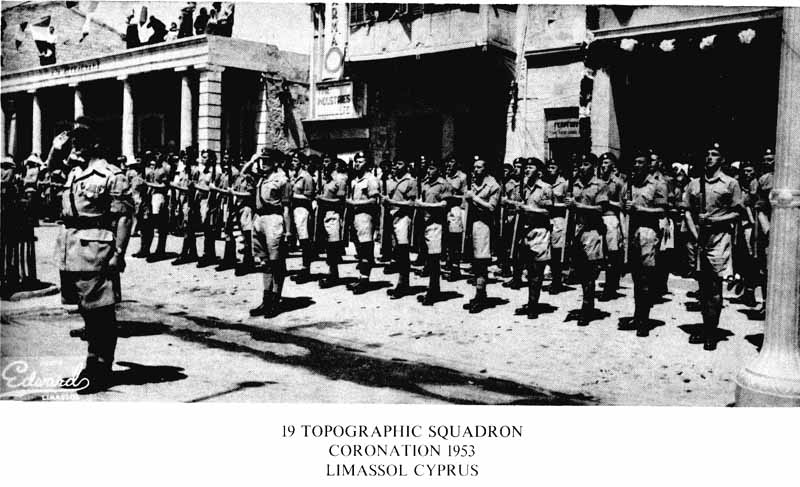
CYPRUS 1952 - 1953
In May 1952 one Troop was sent to Cyprus and the remainder of the Squadron joined it there in October under the onittiand of Major G S J Garwood. The initial task was the establishment of ground control for a 1:2500 survey of a proponed base area and this was completed by July. A pipeline and camera range control task followed, both of which were completed by November when the Squadron in toto was employed on an extensive 1:500 scale survey involving sixty sheets. In September 1953 the Squadron commenced a move back to Iraq. 3 Troop remained behind till February 1954 to complete a survey at Ayios Nikolaos. During its stay in Cyprus the Squadron took part in the Coronation Parade in Limassol.
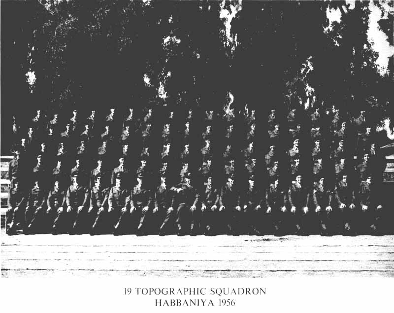
IRAQ 1953 - 1958
The Squadron was to be employed in Iraq for five years on topographic /napping work at scales of 1:20, 000 and 1:100, 000. This was to be a challenging and satisfying period in this largely desert but nevertheless beautiful and rugged country. The Squadron, initially under the command of Maj D M Gunn, was based in Habbaniya which was to become an Iraqi Air Force Base in 1956, but with RAF staging facilities. The main task was again control and field work for 1:100, 000 mapping, but field work was also carried out on the 1:25, 000 GSGS 4870 mapping programme in Kurdistan. This involved the revision of topographical detail and names collection to bring Huntings Surveys contract mapping up to the military specification.
Close liaison was established with the Iraq Civil Survey Department but the Squadron was required by the Iraqi government to work in mufti, not to carry arms, to use vehicles painted in civilian colours and not to move in convoy. These restrictions gave a certain piquancy to the work. In the early clays the Ordnance Corps provided the men with pinstripe three-piece demob suits, civilian shirts and tics and porkpie trilbys. The OC had the satisfaction of parading one troop in this dress at a mountain survey camp before the COG Middle East Land Forces, General Sir Charles F Keightley GCB, KBE, DSO. The training effort involved in raising trilbys for the dismiss was rewarded by a subsequent improved issue of working clothing.
Field work was clone from February till mid December with one monthts break for military training. Predictably, vehicles suffered from the excessive cross country driving, but from mid 1957 arrangements were made for replacement vehicles up to one quarter the establishment to be held immediately available in reserve at Habbaniya.
Although the Squadron was organised on a three troop basis, each commanded by a Subaltern, most of the work was carried out by small parties working hundreds of miles from base. Young surveyors were required to work alone in this rugged mountain country, hiring mules and buying food from the locals. Each area of between one and three sheets (30 to 100 square miles) would take anything from three to fourteen days to cover, during which time the surveyors would find accommodation in the villages. Major J A 11 West the OC for the second part of this task had a very enviable period of command and in an article in the RE Journal described how impressed he was by the splendid results achieved by a succession of National Service troop officers.
In the period July to October 1958 19 Squadron, now under the command of Major D V Hutchinson MBE, became caught up in the Iraqi Coup d'Etat which commenced on 14 July. At this time the Squadron HQ was still at Habbaniya but the troops were deployed on field work. In the post coup period troops were restricted to camp, a curfew was imposed and access to the Squadron lines was restricted. The role of the Squadron in Iraq was treated with suspicion by the new regime and eventually it was reluctantly decided that as field work could not continue the Squadron should be returned to Cyprus.
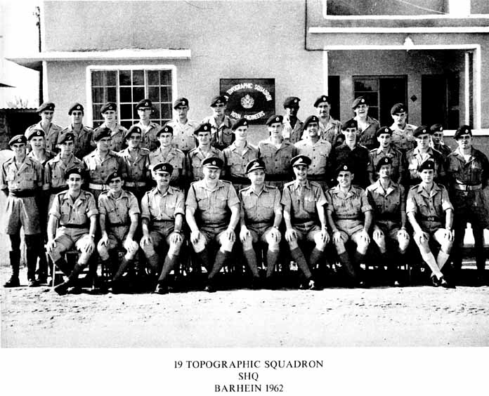
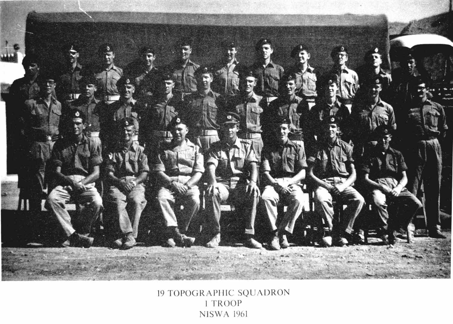
ADEN AND THE PERSIAN GULF 1959 - 1963
In early 1959 two troops of 19 Squadron deployed to work independently in Aden and the Oman. Squadron headquarters followed to Aden in May but in late 1960 moved on to comfortable PWD bungalow accommodation just outside HMS Juffair in Bahrein.
1 Troop was employed for much of the time on photo annotation, identification of control and altimeter heighting for the K668 1:100, 000 series in Oman. It was based first at Muscat and then Nizwa. Work was continually hampered by dissident activity and the consequent need for escorts. In Feb 1961 Spr W D McDougall was killed when his vehicle was mined near Rostak. His driver, Spr Williams, was badly injured. SSgt M Osborne carried out some work in the Liwa Hollows by camel in the company of a Trucial Oman Scouts patrol. On completion of a detachment at Buraimi the troop moved to Sharjah and thence to Tarif on 6 Nov 61. The mapping task continued along the coast towards Abu Dhabi and in June 1962 the troop returned to Sharjah and was eventually joined in December 1962 by 2 Troop.
2 Troop had moved to Oman from Aden in Dec 1960, its initial base being Ibri and later Manama. It worked on the K668 series in the Jebel Akhdar area. Three casualties resulted from a mined 3 ton vehicle and in another incident in May a second vehicle was destroyed. The troop hosted surveyors from HMS Dalrymple during this period establishing good relations with their ship-borne counterparts.
While SHQ was in Bahrein the last national serviceman in the Gulf, Spr A N Reid a clerk in 2 Troop, finished his service and was given a ceremonial farewell.
In Feb 1963 some married families were flown from the UK to Aden and the Squadron moved to Aden in the LST Empire Grebe via Dubai and Mukalla. On their departure the Commander Land Forces Persian Gulf sent the following message "The very best of luck to you in your next location. You have all done a first class job in this area often under most trying and even hazardous conditions. Thank you all very much".
ADEN 1963 - 1964
The Squadron disembarked on 13 March 1963 and its base became Falaise Camp, 5 miles outside Little Aden. The Squadron was initially under the command of Major G J F Holden but Major W D Rushworth took over in June prior to commencemen* of field work, which consisted mainly of tellurometer traverse control. In July 2 Troop joined 1 Troop at Ras Ara to carry out altimeter heighting and photo annotation in the area. The two troops then went their separate ways working west and north. In early November 1963 the squadron commenced preparations for return to the UK and the last two members of the unit, WO2 T Higgins and LCpI J Shaw, left on 28 January after the final hand over of stores to 13 Squadron. Thus after almost a quarter of a century spent continually overseas the Squadron finally returned to the UK to join 42 Survey Engineer Regiment, based at Barton Stacey in Hampshire.
THE UK 1964 - 1977
The arrival in the UK heralded a completely new way of life for the squadron and many must have missed the old days. The period of almost continuous full time independent employment on field surveys for series mapping gave way to a more ordered and static existance.
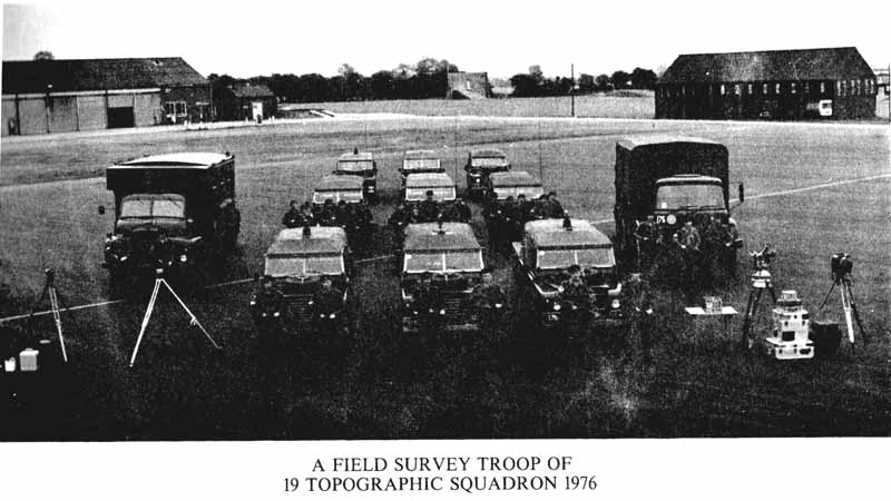
Field tasks both in the UK and overseas have provided much varied employment, but increasingly these have been carried out by small detachments and troops. Only rarely since 1964 has the squadron deployed into the field as an entity, even in the UK. Detachments have often included personnel from 13 Squadron and detachment officers have frequently been cross posted from other Squadrons purely for the duration of the task. In consequence the old sense of continuity of experience and expertise has been difficult to maintain. Mention can only be made in this brief history of some of the major surveys which the squadron has been employed on in recent years, and naturally the overseas projects feature most but the squadron remains heavily committed to surveys in support of the Services in UK.
Sarawak 1964. 1 Troop under Captain Baker carried out plan and altimeter control for 1:50, 000 mapping of Borneo utilising helicopter and light aircraft support between February and August 1964. 3 Troop under
Captain Newberry relieved 1 Troop and between August 1964 and February 1965 completed another mapping block. Helicopter techniques were developed and refined and these detachments really heralded the now accepted need for air support in rugged overseas countries.
Aden 1965. 3 Troop under Captain Ward carried out work in Aden in support of 13 Squadron from March to August completing a tellurometer traverse connection from the Yemen border to 13 Squadron work in Aden.
Lt D N .Joseland took 1 Troop to Aden between November 1965 and April 1966 and did further control work in the Eastern Aden Protectorate and on Masirah Island.
Norway 1965. Major Hunt took a detachment on the first of many mapping exercises in Norway.
Western Isles Astro Tasks. A series of detachments to Scotland have contributed geodetic data towards determining the true shape of the earth. Gravity surveys have also been carried out.
Ireland 1966. A party under Major NI D Prescott MBE carried out Laplace observations at two locations 180 miles apart as a check on the Irish azimuthal variation in the trig network. This task revived the cooperation between the Military Survey and the national survey in Ireland which had been originated in the 1820s.
Libya 1969. Captain A P J Savage carried out an EDM traverse survey of parts of Libya for subsequent air survey mapping between January and April.
Tranet 1970 - 1977. In 1970 a Tranet Station was set up at Barton Stacey to contribute towards the US Navy Navigation Satellite system. Lt J C,ritchley had been sent to Washington to learn the methods and was then responsible for initiating the station. It has continued in operations ever since and is a significant contribution towards joint UK - US geodetic survey work.
New Guinea 1970. A troop under Captain M A Nolan deployed to New Guinea and joined a programme of Acrodist mapping control work in support of the Royal Australian Survey Corps between July and December. This is the only time that RE Military Survey has been involved in this technique, apart from earlier trials of the system in UK.
Australia 1971. Lt B F Gerhard took a detachment to Australia to furnish control for an Australian photogrammet ric range at Bonegilla near Lake Hume.
West Indies 1971. Captain J A N Croft, two surveyors and one assistant carried out a gravity survey in the West Indies in September and October.
Kenya 1972. An enlarged troop under Captain G P G Robinson provided traverse and altimeter height control for a 1:100, 000 mapping project cast of Lake Rudolph.
Australia 1973. Captain T J Zorichak took a troop to Australia to continue work on the Lake Hume Range.
Wales 1973. Major C R Cronchey the OC achieved the commendable aim of deploying virtually the whole of the Squadron under canvas on a trig task in Wales in support of OS work, from May to June.
Cyprus 1974. Lt P Wood carried out a Troop traverse task in the Troodos Mountains of Cyprus providing revised control for new 1:5, 000 scale mapping of Cyprus from April to June.
Kenya 1974. Major J W Williams took most of the Squadron to North Kenya to carry out a demanding and ambitious EDM traverse to geodetic standards using Bilby towers. This highly successful detachment was carried out in very demanding conditions.
Norway 1975. Major M A Nolan took a large detachment from the Squadron to the Voss area of Norway to identify Norwegian control points and annotate all areas for subsequent production of four 1:50, 000 map sheets using helicopter support for deployment and photographic identification techniques.
Cyprus 1976. Captain F G Noseworthv RCE took a troop to Troodos and Episkopi to carry on similar work to that of the 1974 season and successfully used AAC helicopter support in the mountains.
Scotland 1976. Captain B V Burton's troop carried out an important geodetic survey at RAE West Freugh to fix a number of kinetheodolite sites used for recording aircraft trials. First order plus observations and levelling were carried out.
Kenya 1977. Captain B V Burton took a 50 strong detachment, transport and two Scout helicopters to Kenya from December 1976 to February 1977 and completed a Geodetic loop from each end of the 1974 work.
Belize 1977. Captain S R Campbell R Aust Syy, is due to take a detachment for the first time to Belize to carry out mapping support for the British Forces in Belize four days after the 150th Anniversary.
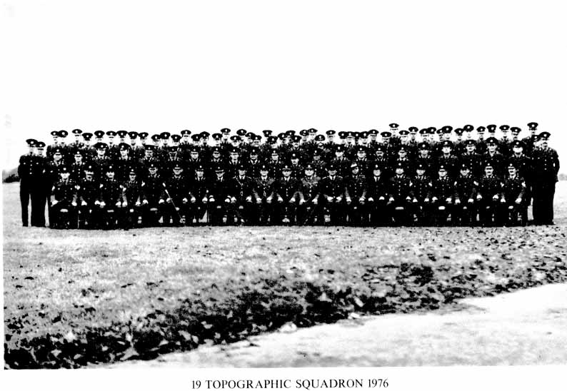
Back Row:
LCp1 M Kilfoyle, Spr J N Adlington, LCp1 M N Jackson, LCpl N W Beckwith, LCpI B S Willis, Spr M N Moore, Spr L Mitchell, Spr A Redman, LCpI B Franklin, Spr F .1 McLaughlin, Spr B Evans, Spr T Bunday, Spr D Haig, LCpI W A Walters, Spr D Lister, Spr C M Jones, Spr K Davies, Spr C D C Mackellar, Spr D J Boulton, Spr L E Appleton, LCpl G S Adcock, Spr M E Oxley, LCpI B D Biggs, LCp1 F M Thomas, LCpl D M Spence, LCpI M J Herring.
2nd Row:
Cpl S R Bridge, LCp1 J M Firth, LCpI J II Vickery, Cpl J Crompton, Cpl J S Scaife, Cpl G Mortimer, LCpI G A Asbery, Cpl B Geddes, LCpI J C Moore, LCpl C P S Viner, LCpI A J Cowan, Cpl K Smith,
LCpI C A J W Nicklin, Cpl R J Brown, LCpI C A Bayliss, Cpl J Holden, LCpI D W Oram, LCpI K J Pavior,
Cpl N R S Macdiarmid, Cpl R M Nicklin, Spr C J Madden, Cpl P D Cox, LCpI P D Fassam, Spr M A Fothergill.
3rd Row:
Sgt E Davies, Sgt B J Clark, Sgt R C Brown, Cpl N Ilodgkiss, Cpl B R Hibbert, Col J P Knight, Cpl P T Starr, Cpl A J Barnes, Cpl B F V Gent, Col W P Peachey, Cpl R Lindsey, Cpl C C Babbage, Cpl I Barwood, Cpl C H Moorhouse, Cpl C J A Thompson, Cpl P Thorn, Cpl A Shaw, Cpl T R Richards, Cpl D C Morris, Cpl A J Borkowski, Cpl P Fox, Sgt A J Lee, Sgt P H W Horton, Cpl C Hastings.
Front Row:
Sgt G C Thornton, Sgt A E Dow, Sgt P J Fassam, SSgt R Stockley, SSgt C M Branson, WO2 W G Roberts, WOl J A C Shaw, Capt F G Noseworthy, Capt M Harvey, Capt J Critchley, Maj M A Nolan, Maj W J Jenkins, Capt B V Burton, Capt S R Campbell, WO A J Mandoli, WO2 M J Gowlett, SSgt R G Gray, SSgt M R Guise, WO2 A Thompson, SSgt N S Gilhespie, Sgt J W Miller.
|
|
|
LIST OF KNOWN OFFICERS COMMANDING |
|||
|
1870 |
- 1872 |
Captain R M PARSONS |
1938 |
1939 |
Captain H C SMITH |
|
1873 |
- 1874 |
Captain GH BOLLARD |
1939 |
1940 |
Lt Col R LI BROWN |
|
1875 |
|
Captain A HILL |
1940 |
- 1942 |
Major R II DENNISS |
|
1876 |
- 1377 |
Captain F W NIXON |
1942 |
- 1944 |
Major F Q MANSFIELD |
|
1878 |
- 1882 |
Captain W St C BURKE |
1945 |
|
Major J RIIYATT |
|
1883 |
- 1887 |
Major A A W BEAMISH |
1945 |
1946 |
Major A J 1IERBERT |
|
1887 |
1889 |
Captain E R HUSSEY |
1948 |
- 1949 |
Major WALMSLEY-WHITE |
|
1890 |
- 1891 |
Captain NI E BISSET |
1949 |
- 1950 |
Major D J SUTER |
|
1892 |
- 1894 |
Captain S C N GRANT |
1950 |
- 1951 |
Major J W TAYLOR |
|
1895 |
|
Major C E HAYNES |
1951 |
1952 |
Major W L COVING'I'ON |
|
1895 |
- 1898 |
Captain R P LEE |
1952 |
- 1953 |
Major C S J GARWOOD |
|
1899 |
- 1903 |
Captain W C HEDLEY |
1953 |
- 1956 |
Major D M GUNN MBE |
|
1904 |
- 1907 |
Captain P T DENIS de VITRE |
1956 |
- 1958 |
Major J A H WEST |
|
1908 |
- 1910 |
Captain C St B SLADEN |
1958 |
- 1959 |
Major D V HUTCHINSON |
|
1911 |
|
Captain J E E CRASTER |
1959 |
|
Major G A HARDY |
|
1911 |
- 1913 |
Captain G A P BROWN |
1959 |
- 1961 |
Major I D HART |
|
1914 |
- 1915 |
Captain J G HEATSON |
1961 |
1963 |
Major G J F HOLDEN |
|
1916 |
- 1919 |
Major A C ROBINSON |
1963 |
- 1965 |
Major W D RUSHWORTH |
|
1920 |
- 1923 |
Captain E H NI CLIFFORD MC |
1965 |
- 1966 |
Major P J HUNT |
|
19 24 |
- 1925 |
Captain K M PAPWORTH MC |
1966 |
- 1967 |
Major N J D PRESCOTT |
|
1925 |
- 1926 |
Captain C S V COOKE MC |
1967 |
- 1969 |
Major H C HONEYMAN |
|
1927 |
- 1929 |
Lt N A M SWETTENHAM |
1969 |
- 1971 |
Major R J CLINT |
|
1929 |
- 1932 |
Incorporated in Survey Battalion |
1971 |
- 1973 |
Major G R CRONCHEY |
|
1932 |
- 1933 |
Captain F 0 METFORD |
1973 |
- 1974 |
Major J W WILLIAMS |
|
1933 |
- 1935 |
Lt L F de Vic CAREY |
1974 |
- 1977 |
Major M A NOLAN |
|
1935 |
- 1937 |
Captain S G HUDSON |
|
|
|
This history has been compiled by scanning the 150th Anniversary programme and OCR, I have proof read it but would be grateful for any corrections that I have missed
Also if anyone has copies of the photographs used I would be grateful
Albie